Welcome to the Best Waterfalls In Iceland guide. I bring you to the most iconics waterfalls of Iceland like Godafoss, Gulfoss, Dettifoss, Skogafoss which are very accessible from the road 1 to more off-the-beathen-path but wonderful waterfalls like Bruarfoss and Aldeyjarfoss. After many trips in Iceland, it’s time for me to share my knowledge and experience with you .
Waterfalls in Iceland are very impressive by theirs size and theirs powerful streams and beautifully enhanced by the raw landscape of Iceland. The reason is climate related. The country gets a lot of rains and the melting of glacier produce powerful rivers. Many have magnificent basins carved into the basalt base by the waves like Godafoss or Aldeyjarfoss or by the catastrophic floodings of the past , due to volcanic eruption, that hollowed out canyons like Dettifoss .
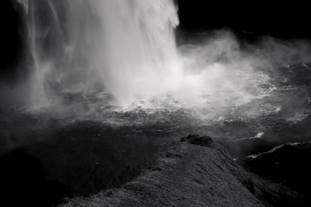
Others, like Skogafoss or Seldjalandfoss, fall from a cliff that was once the sea shore when the ocean level was higher than today.
The rich Viking history has spawned legends, stories or elements of folklore associated with Icelandic waterfalls.
Needless to say that the beautifulness of the icelandic waterfall allowed them to appear in TV series or films such as Game Of Thrones or the Alien series.
For a more extensive guide about waterfalls in iceland, I invite you to consult the Iceland Waterfall Guide .
Table of contents
- Godafoss
- Aldeyjarfoss
- Kirkjufellfoss
- Skogafoss
- Gulfoss
- Fossarrett
- Seldjalandfoss
- Bruarfoss
- Svartifoss
- Oxararfoss
- Hraunfossar
- Barnafoss
- Dettifoss
- Selfoss
- Urridafoss
- Dynjandi
- Fossalar
- Complements to the Best Waterfalls In Iceland Guide
- Reference to the Best waterfalls In Iceland guide
- FAQ Best waterfalls In Iceland guide
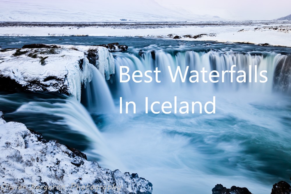
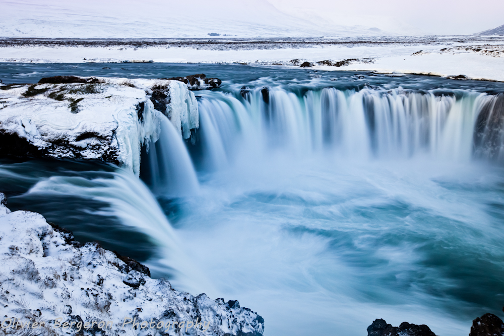
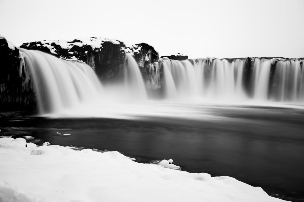
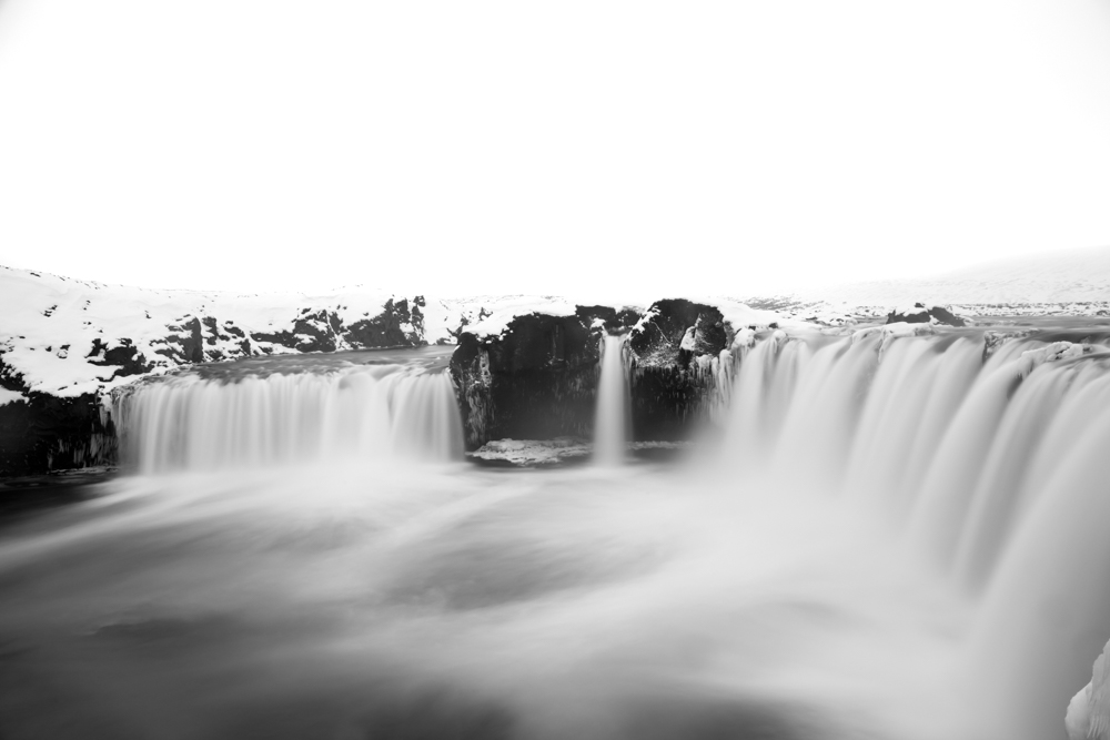
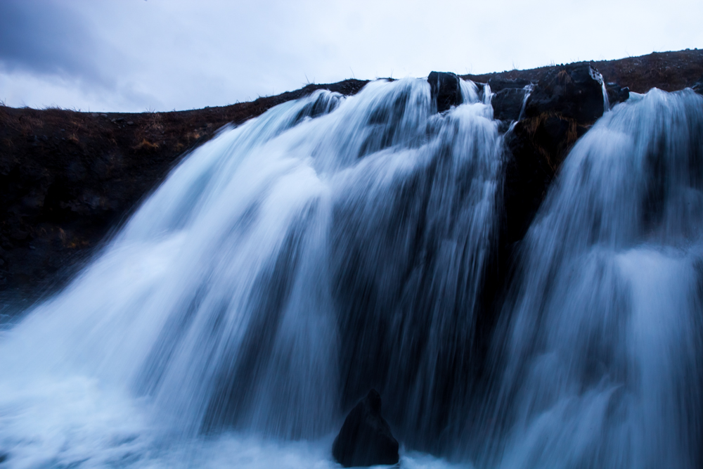
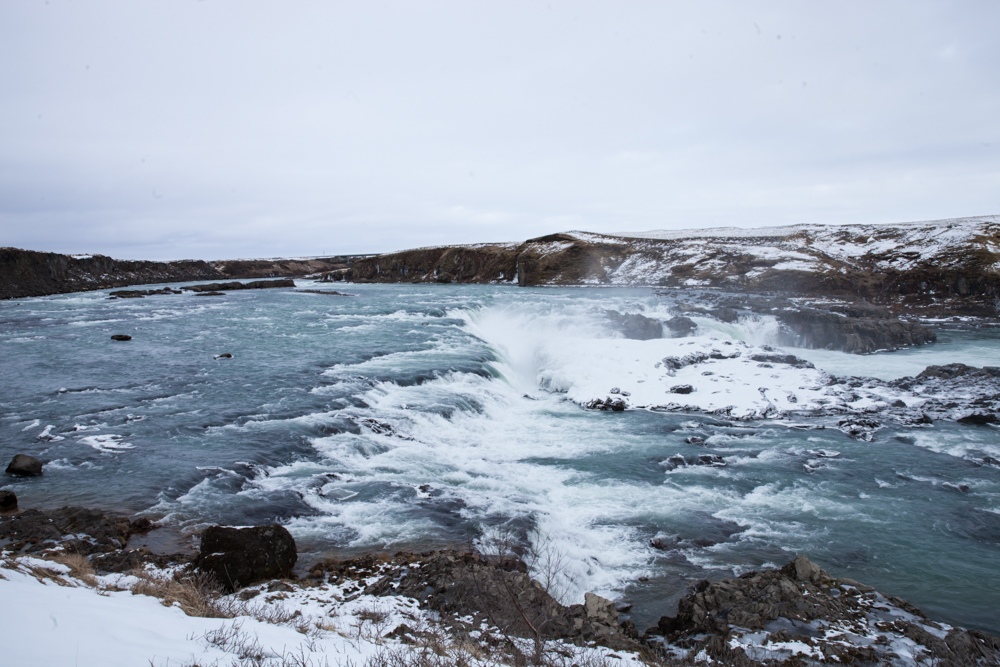
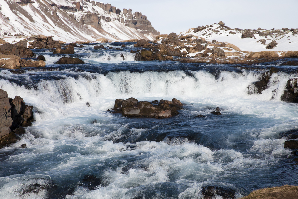
Godafoss
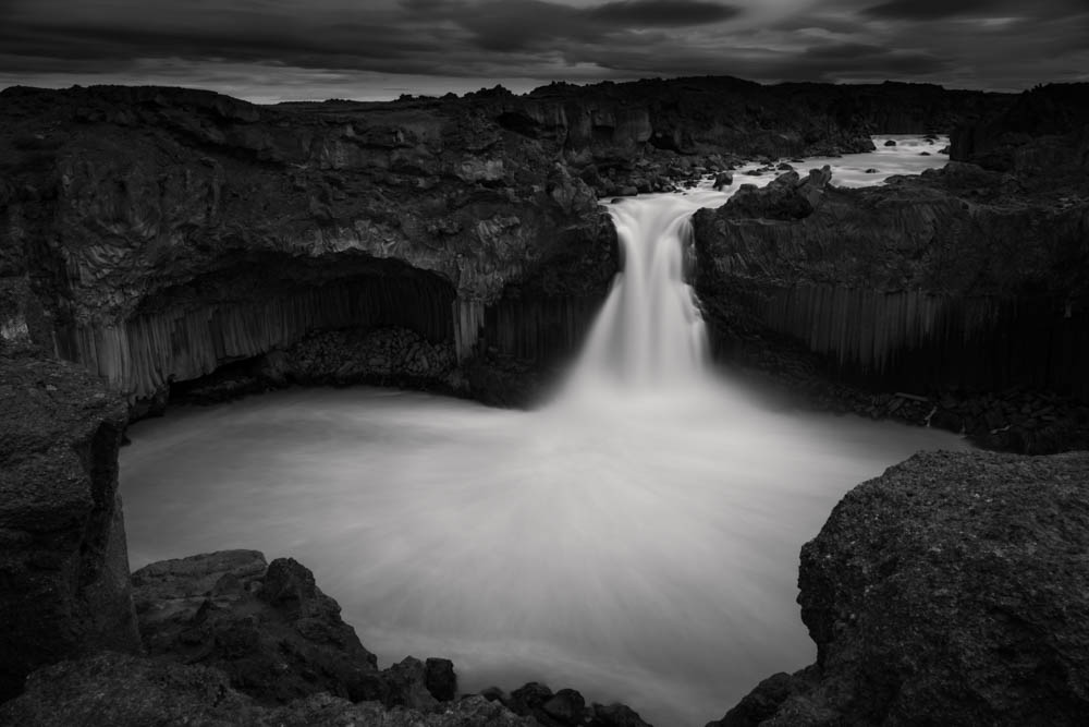
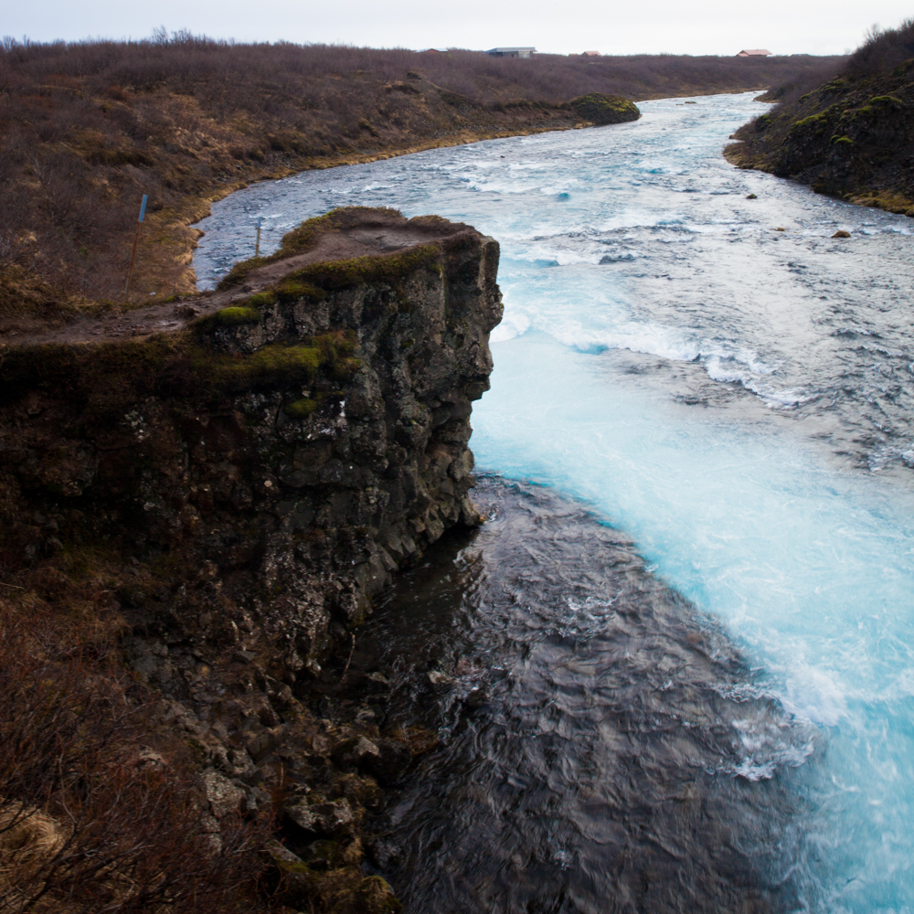
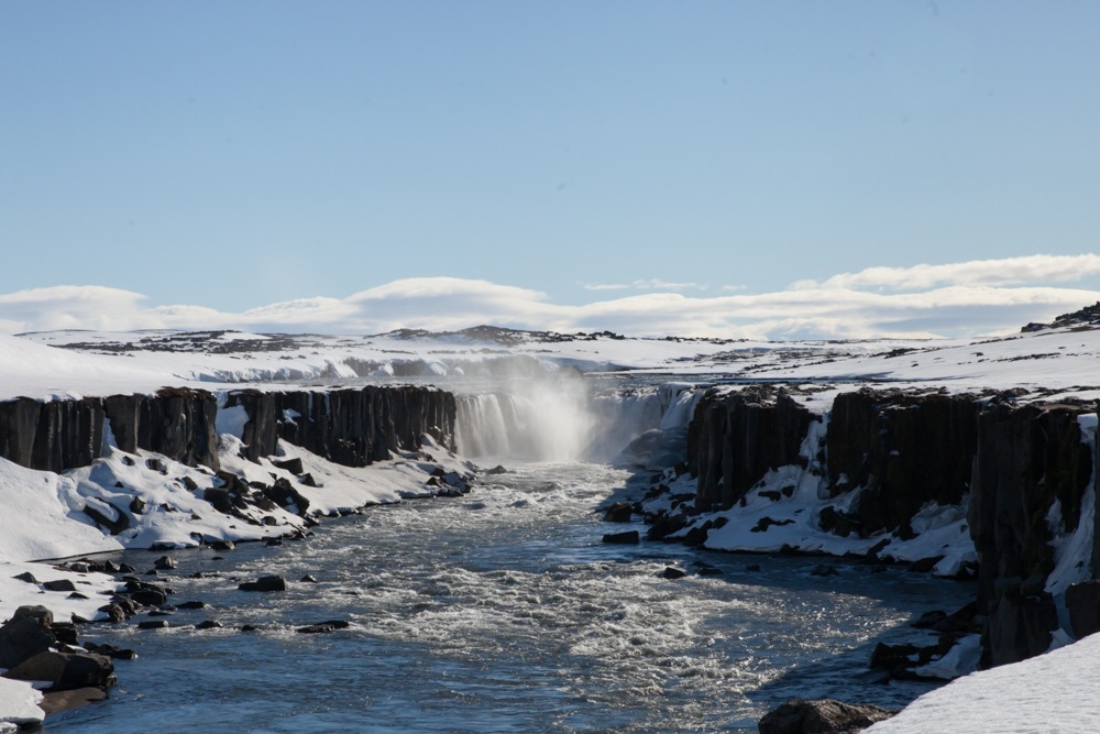
My favorite and one of the most beautiful waterfalls in this Best Waterfalls In Iceland Guide, Godafoss has a superb horseshoe-shape and waters have often a beautiful blue or blue-green color. Certainly I could stay hours to photography it and I like to take long exposure photographs of this magnificent waterfall. It is useful to specify that the two banks of Godafoss, are photogenics. In addition, my favorite weather conditions are in winter when Godafoss is surrounded by a snowy landscape.
Godafoss can be reached very easily from Route 1. It is located in the north between the town of Akureyri and Lake Myvatn. A large car park gives access to the west bank of the river.
A small car park after the N1 station on route 844 provides access to the east bank of Godafoss.
Godafoss is located on the Skjálfandafljót river. More precisely, the water of the river falls from a height of 12 metres (39 feet) over a width of 30 metres (98 feet).
Godafoss Legend
Legend : In modern icelandic , Goðafoss could means either waterfall of the goð (pagan idols) or waterfall of the ‘goði’ (chieftain). According to the legend, after the lawspeaker Þorgeir Ljósvetningagoði made Christianity the official religion of Iceland in the year 999 or 1000 at the Althing (one of the oldest parliaments in the world) at Thingvellir , when returning home, Þorgeir supposedly threw his statues of the Norse gods into the waterfall. However no trace of this act is recorded despite the role of Þorgeir in christianity adoption preserved in the Íslendingabók. It could be a creation of the nineteenth century.
Another explanation is given by linguist and placename expert Svavar Sigmundsson who suggests that the name derives from two crags at the falls which resemble pagan idols.
Photographers Tips
The site is sometimes very windy in winter. Often i need to stay on my knee upon snow , holding tight my tripod.
Bring some handkerchiefs or cotton for clean the lens of your camera. The strong wind project snow or rain in winter.
Bringing a neutral density filter allow to get some somptuous long exposure shots.
Amenities
Oil : Pump station N1 at Godafoss near the Fosshóll Guesthouse .
Food : Snacks at the N1 pump station.
Accomodation :
- Fosshóll Guesthouse , 645 Fossholl, Iceland
- Skjaldarvik Guest House, Skjaldarvík Guest House Road 816, 601, Akureyri, Iceland
- Dimmuborgir Guesthouse , Geiteyjarstrond 1, 660 Myvatn, Iceland
- Vogafjós Farm Resort , Vogafjósi, 660 Myvatn, Iceland
Godafoss waterfall location coordinates
GPS : 65.682878, -17.550214
65°40’58.4″N 17°33’00.8″W
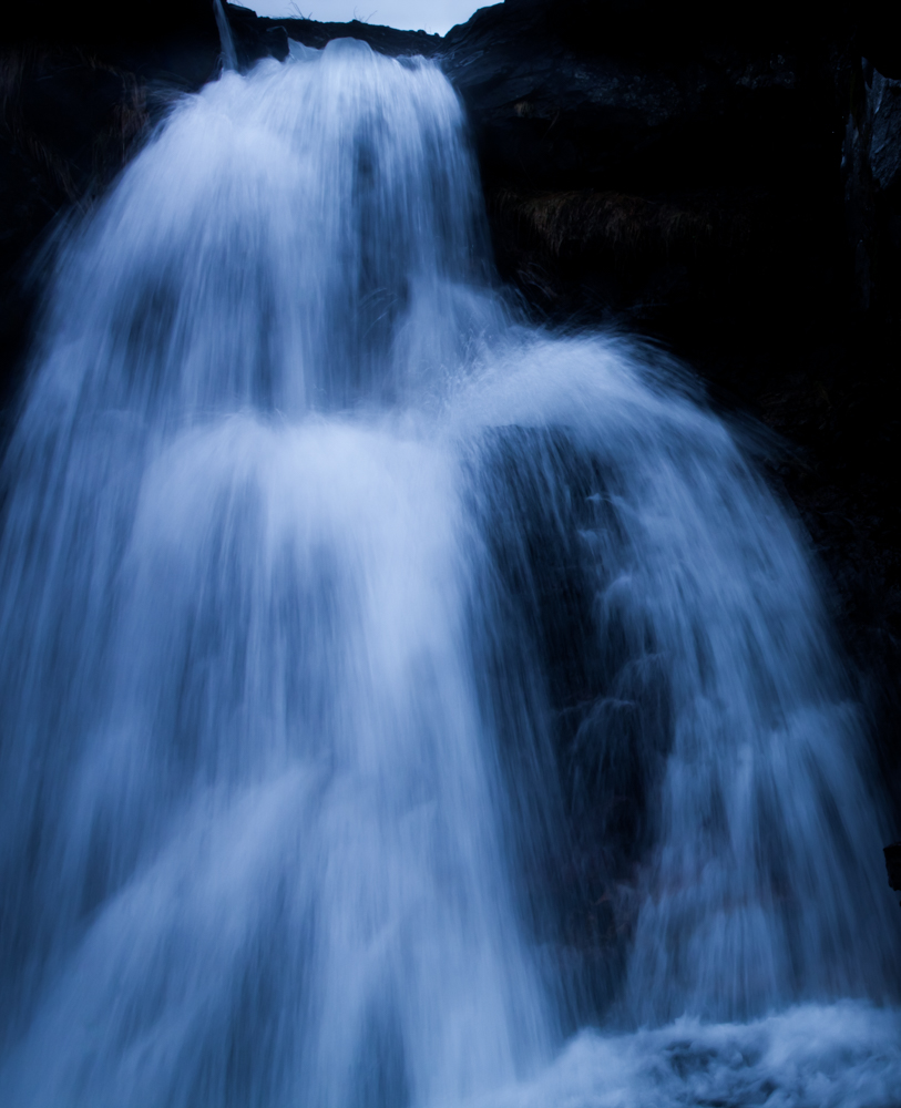
Aldeyjarfoss
Like Godafoss which she is not too much far, Aldeyjarfoss is a majestic waterfall in Iceland and one of my favorite . They are both located in the highlands of North Iceland between Akureyri and the lake Myvatn.
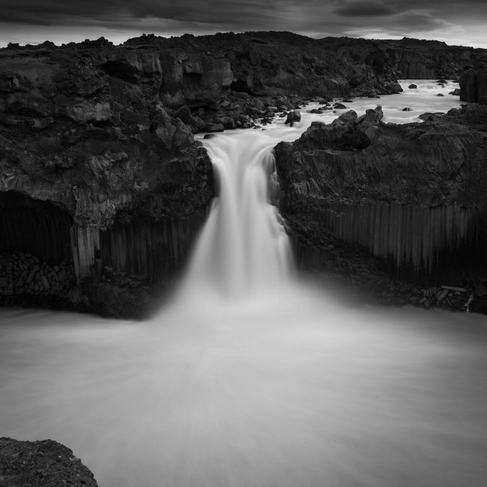
The waterfall Aldeyjarfoss is of an amazing beauty, surrounded by basalt column. The stream pours from a height of 20 meters in a horseshoe-shape basin.
Off-the-beaten-path, you can access Aldeyjarfoss from the road 1 by the road 842 , a gravel road, and by the road F26 more rocky with a 4 wheel drive car, relatively easily in summer. The distance is around 40 km from the road 1. At the end of the road of the road 842 you need to open a gate (don’t forget to close it !) or let your car if you don’t have a 4×4 and hike around 40 minutes to reach the waterfall. This part could be hard in deep winter with heavy snow and you may need to rent a super jeep and/or a guide .
In the heart of winter 2015, I try to access by the road 843 parallel to the river. After a scary passage on a small bridge cover by heavy snow with my 4 wheel, we finally give up the final walk to the waterfall due to heavy wind and snow projection.
Photography tips
During my recent visit, the water was very muddy and greyish so I only shoot some long exposure photography. My settings were F18, Iso 100. exposure time 30 seconds with a ND1000 neutral density filter. I hope to come back Aldeyjarfoss in winter for get a magnificent blue water and get some good shots.
Amenities
Oil : Pump station N1 at Godafoss near the Fosshóll Guesthouse .
Food : Snacks at the N1 pump station at Godafoss.
Accomodation :
- Fosshóll Guesthouse , 645 Fossholl, Iceland
- Skjaldarvik Guest House, Skjaldarvík Guest House Road 816, 601, Akureyri, Iceland
- Dimmuborgir Guesthouse , Geiteyjarstrond 1, 660 Myvatn, Iceland
- Vogafjós Farm Resort , Vogafjósi, 660 Myvatn, Iceland
location coordinates Aldeyjarfoss GPS : 65.366643, -17.337055
65°21’59.9″N 17°20’13.4″W
Kirkjufellfoss
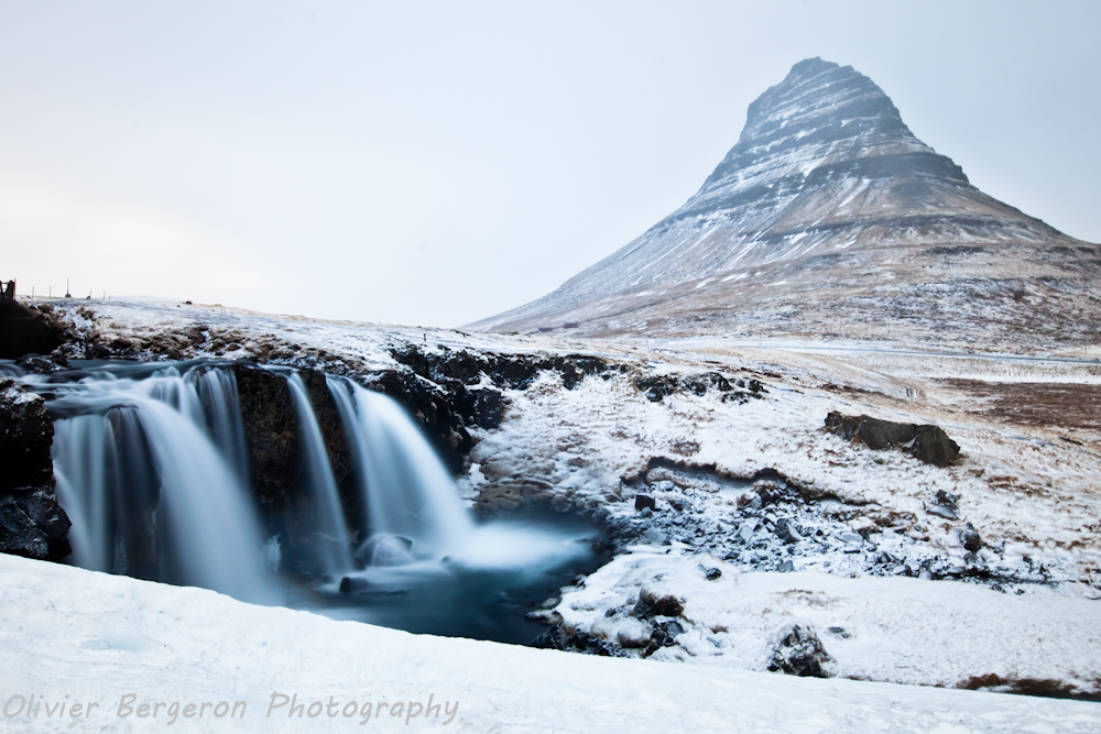
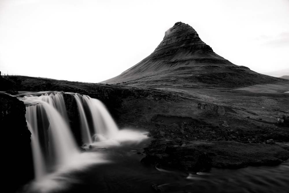
No need to present the Kirkjufell, iconic mountain of the Snaefellnes peninsula, Kirkjufellfoss is the very photogenic small waterfall of the Kirkjufellsa river. Kirkjufellfoss is very easy to reach from road 54 past the town of Grundarfjordur. A small path leads directly to the waterfall from the small parking lot (beware of slipping in the presence of ice).
Kirjufellfoss appears in the season 6 of the Game Of Throne serie when the children of the forest created the first White Walker.
Amenities
Oil : Pump station N1 in the city of Grundarfjörður near the Samkaup food shop in the center of city and Orkan a little bit outside , Suðurgarði 1, 350 Grundarfjörður, Iceland.
Food : Not too much choice, we usually cook in guesthouse, Samkaup, grocery store in center of the city of Grundarfjordur.
59 Bistro Bar , Grundargata 59, 350 Grundarfjörður, Iceland
Accomodation :
- Grund í Grundarfirdi , Grund í Grundarfirdi, 350 Grundarfjordur, Iceland
- Búlandshöfdi 350, 350 Grundarfjörður, Iceland
- Stöð Guesthouse and apartments , 13 Sólvellir, 350 Grundarfjordur, Iceland
location coordinates Kirkjufellfoss GPS : 64.926749, -23.311337
64°55’34.7″N 23°18’39.3″W
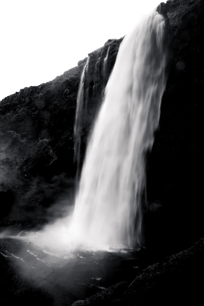
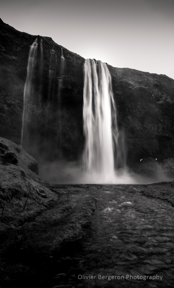
Skogafoss
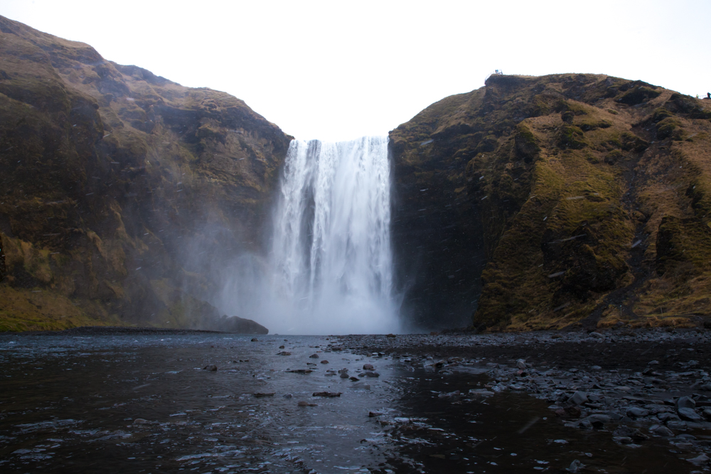
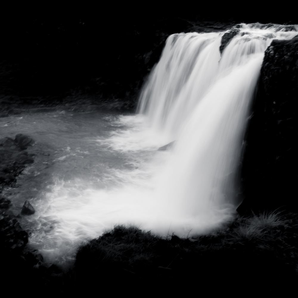
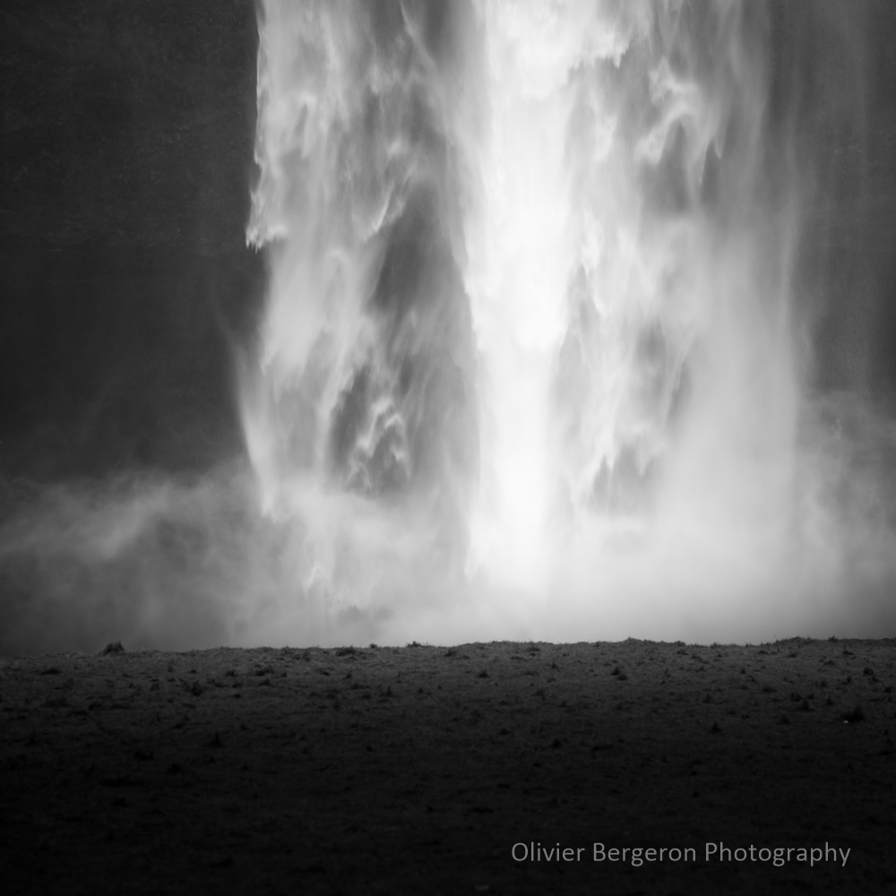
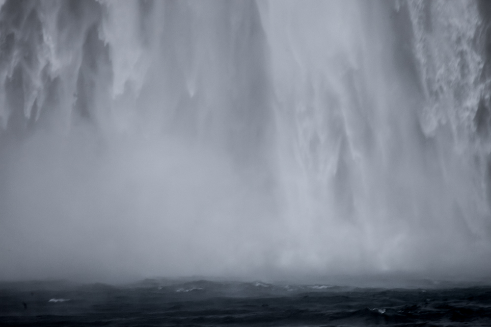
Falling from a rocky cliff, Skogafoss is a striking, huge and iconic waterfall of the South Iceland on the Skoga river. The water drop from a height of 60 meters. Skogafoss is pretty wide too with a width of 25 meters. Many birds surround the waterfall and live on the cliff. The cliffs are the former coastline of South Iceland in the time where the level of water was more high.
The access to Skogafoss is very easy from the road 1 between Hvolsvöllur and Vik. In addition, the waterfall is visible from the road 1.
A steep staircase leaeds to a platform above the cascade where you can see Skogafoss from the top.
It’s easy to combine the visit of Skogafoss with the visit of the Seldjalandfoss waterfall.
Skogafoss Legend
Legend :
According to a legend, a treasure in a chest was buried in a cave behind the Skogafoss waterfall by Þrasi Þórólfsson , one of the first vikings settlers in the area. After many attempts, locals finally found the chest years later, but were only able to grasp the ring on the side of the chest, the ring broke and the chest disappeared. The ring was allegedly given to the local church and finally arrive to the Skogar museum.
Culture
Skogafoss appears in the serie Vikings during the season 5 when the viking character Floki discovers Iceland.
Additionally in the serie Game Of Throne during the season 8, the characters Daenerys Targaryen and Jon Snow fly over the skogafoss waterfall.
Furthermore, Skogafoss is a location in the movie Thor The Dark World and for the movie The Secret Life of Walter Mitty.
Skogafoss appears in the official music video « I’ll Show You » of Justin Bieber.
Amenities
A hotel and a restaurant are present on the site of Skogafoss.
Oil : Pump station N1 at Hvolsvöllur , Þjóðvegur, 860 Hvolsvöllur, Iceland Or Pump station N1 at Vik, Sunnubraut 27, 870 Vík, Iceland
Food : Skogafoss Bistro Bar, 861 Hvolsvöllur, Iceland on the site of the Skogafoss waterfall.
Accomodation :
- Hótel Skógafoss on the waterfall site, Skógarfoss, 861, Iceland
- Ásólfsskáli Cottage , 16km from Skogafoss, 861 Ásólfsskáli, Iceland
- North Star Cottage, 6km from Skogafoss ,Lambafell Hvolsvöllur, 861 Eyvindarhólar, Iceland
Photographer tips :
Sometimes a rainbow can be seing over the waterfall or the river due to the mist. If you want shoot some long exposure you may need to arrive very early due to the massive amount of tourist and photographers or combine many shoot in photoshop for remove silhouette. Near the waterfall , protect your camera , the spray are very strong and thick.
location coordinates GPS : 63.532127, -19.511421
63°31’55.7″N 19°30’41.1″W
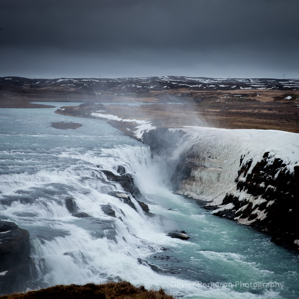
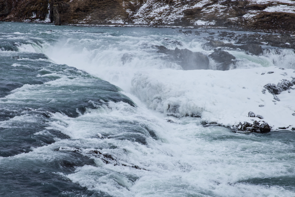
Gulfoss
An impressive site, Gulfoss is a must-see on the golden circle tours in southwest Iceland on the Hvita river. You can easily combine his visit with a visit to the Strokkur and Geysir geysers as well as a visit to the Europe – America plate collapse ditch located at Tingvellir on Lake Tingvallavatn
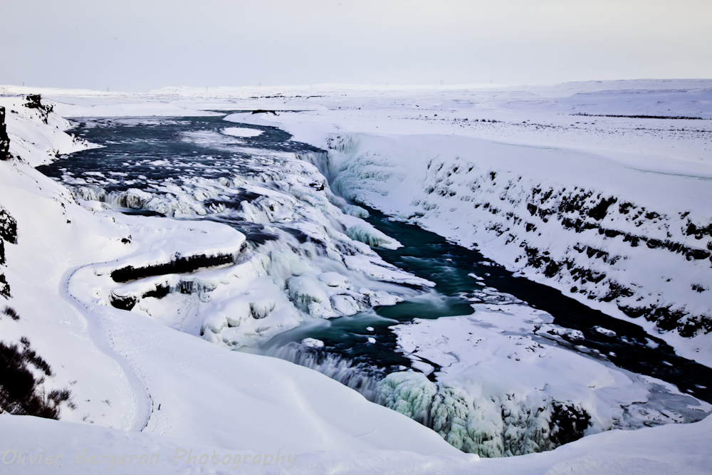
The waterfall is accessible by road 35 and has a parking lot and a store-restaurant establishment
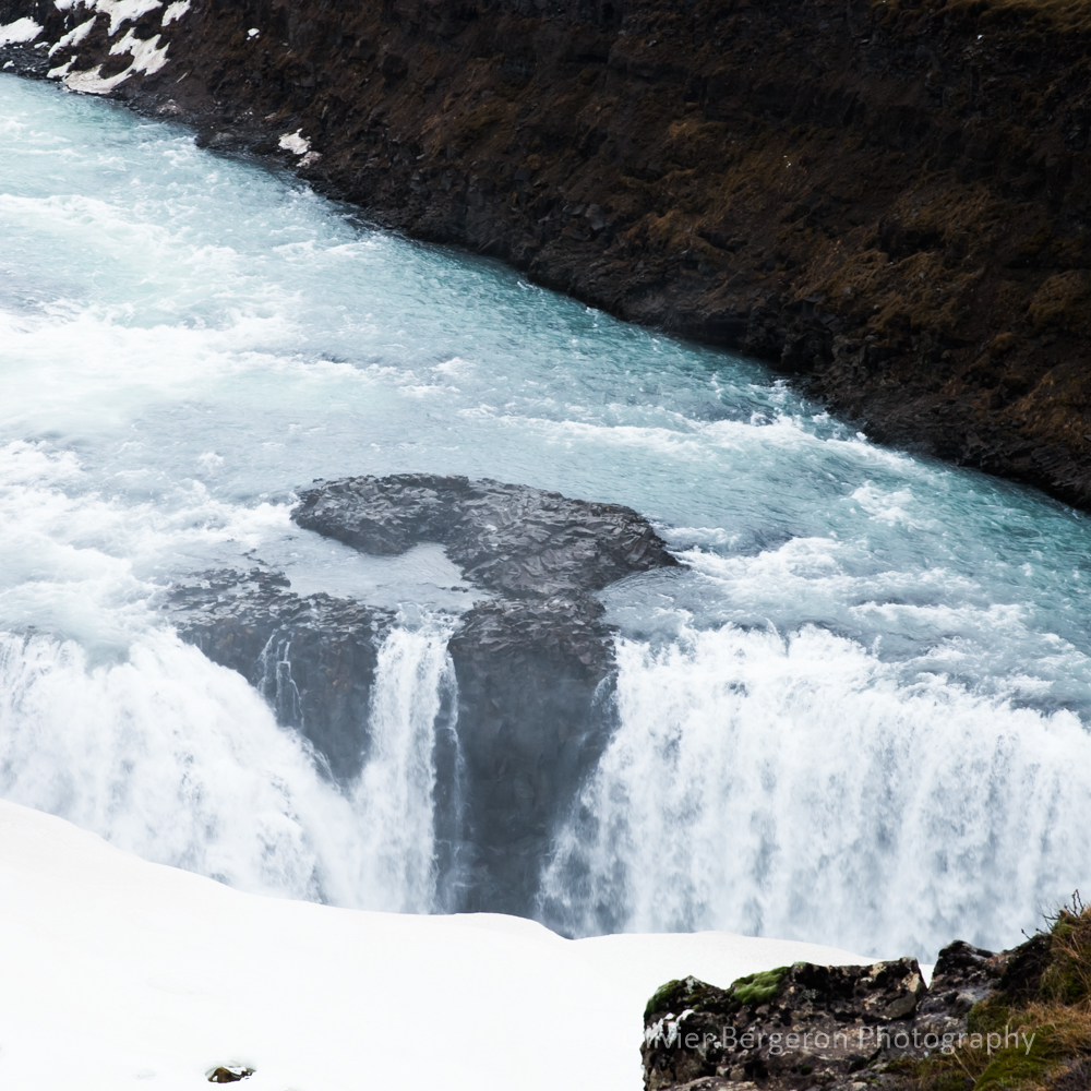
Gulfoss with a total width of 70 meters and a total height of 32 meters is a cascade of several floors.
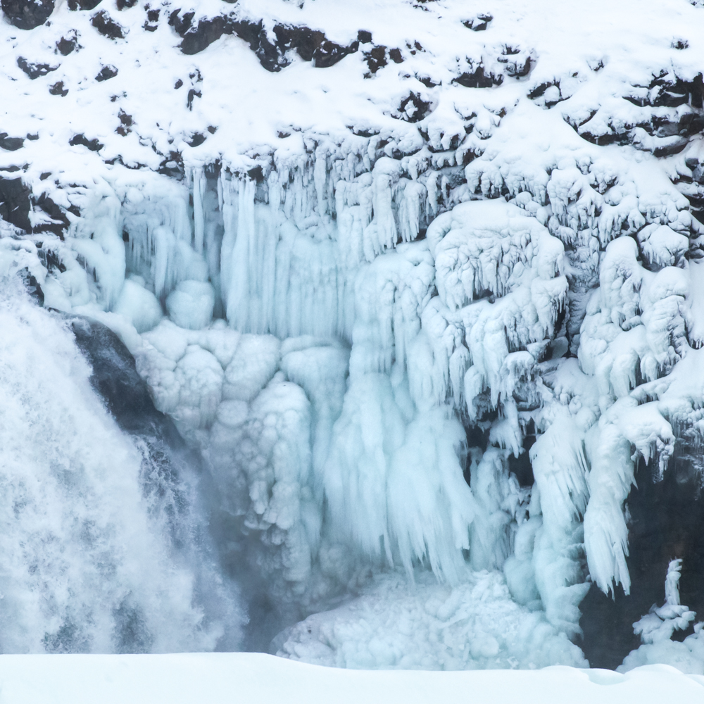
The flooding of the waves in the crevasse is impressive. During my visits in winter, the trail leading to a viewpoint very close to the crevasse was systematically closed due to the heavy snow cover. Photographers such as iurie Belegurschi were able to get magnificent close-ups of the previously frozen crevasse.
The droplets created by the waterfall produce a veil on the photos.
Useful clarification: the small path can be very slippery in winter, cramped soles are very useful. The site is very busy.
Amenities
Oil : Pump station N1 at Geysir and Strokkur, 806 Bláskógabyggð, Icelandd Or Pump station N1 at Laugarvatn, Dalbraut 6, 840 Laugarvatn, Iceland
Food : We usually eat at the restaurant on the Gulfoss site. Our favorite is the lamb soup for eat like an icelandic, tip : the last time we can refill the soup free !!
Accomodation :
- Hotel Gullfoss , Brattholt, 806, Iceland
- Hotel Geysir , Geysir, 806 Geysir, Iceland
location coordinates Gulfoss GPS: 64.325634, -20.124962
64°19’38.5″N 20°07’12.3″W
Fossarrett
Very lovely, Fossarrett is a small, not-so-famous waterfall and that’s a shame. It is very photogenic on a mini long exposure photography.
It is located in the east of Iceland along the Hvalfjordur fjord on route 47.
Amenities
Oil : Pump station N1, Orkan or Olis at Borganes, Brúartorg 1, 310 Borgarnes.
Food : Grillhúsið restaurant, Borganes, Brúartorg 1, 310 . Laxárbakki restaurant ,301, Akranes, Iceland
Accomodation :
- Hotel Laxarbakki , Laxarbakki, 301 Hvalfjarðarsveit, Iceland
location coordinates GPS: 64.359617, -21.452972
64 ° 21’50.9 « N 21 ° 27’13.0 » W
Seldjalandfoss
In the south Iceland, Seldjalandfoss is another iconic waterfall of Iceland . It’s visit can be easily combine with skogafoss. You can get there from the road 1 between Hella and Vik. It’s one of the most beautiful waterfall in iceland. The seldjaland river fall from a height of 60 meter.
That’s possible to walk behind the waterfall but you need to take photos extremely fast due to the huge amount of drops in the air. Be aware that in winter this way can be very slippy.
Seldjalandfoss appears in the official music video « I’ll Show You » of Justin Bieber.
location coordinates GPS : 63.61625, -19.98535
63°36’56.5″N 19°59’19.1″W
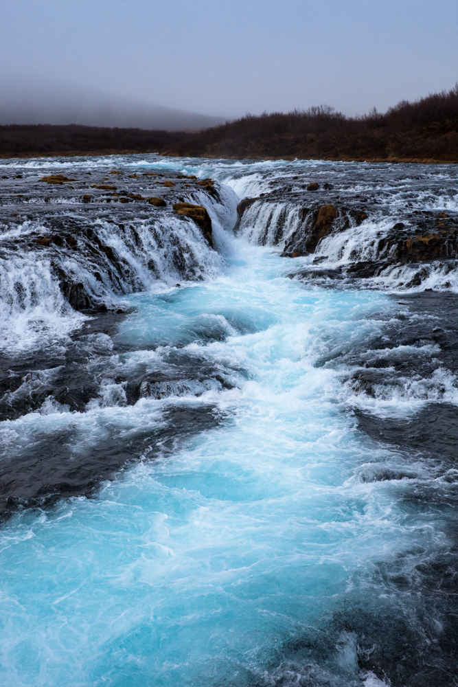
Bruarfoss
Off-the-beaten-path, Bruarfoss is a somptuous blue color waterfall along the Bruara river.
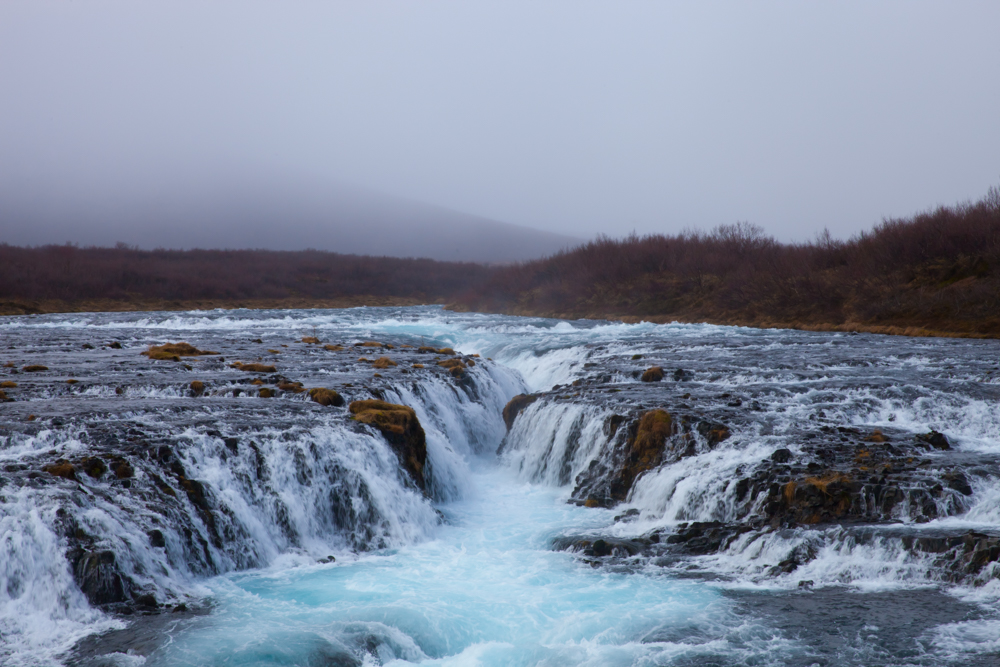
You can get there by the road 37 and combine the visit of Bruarfoss with the visit of Gulfoss after the city of Laugarvatn. You need to stop your car at the parking and walk around 3 kilometers to reach the cascading blue water.
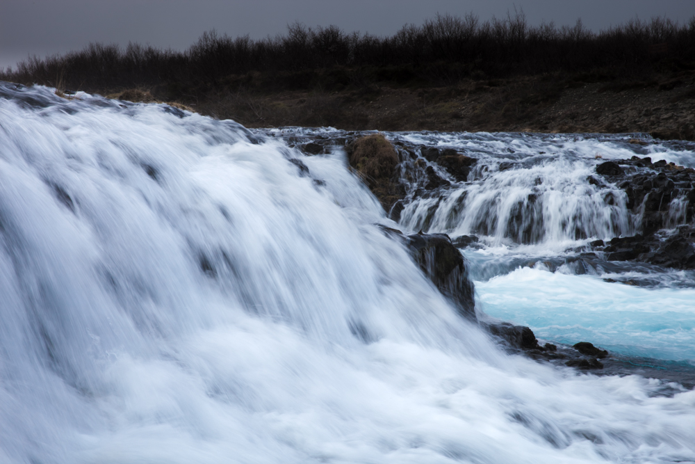
During my visit, the way was very muddy and not so easy to walk, so don’t be afraid to be dirty but the visit was worthy.
.Legend : Near the Brúarfoss, there is said to have been a natural stone arch over the river that gave it its name « Bridge Falls » to the waterfall . In 1602, according to a legend, an employee of the diocese Skálholt destroyed the bridgec in a time of a great famine in Iceland , to prevent the beggars. A little later, the estate manager is said to have drowned himself in the Brúará. Another legend depicts a jealous Danish bishop who was drowned in a sack after an attempted murder of the lover of a young woman
DO NOT let trash during your visit ! One way on private land to Bruarfoss is closed, due to this problem.
location coordinates GPS : 64.26452, -20.51578
64°15’52.7″N 20°30’56.8″W
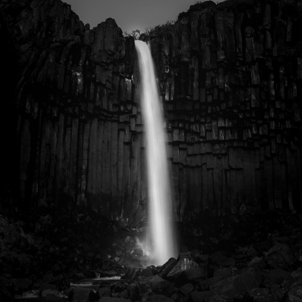
Svartifoss
A majestic waterfall surround by somptuous organ basalt column.
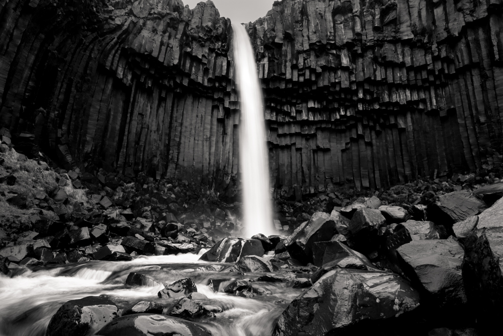
Between Vik and Hofn, take the road 998 from the road 1 and drop your car at the skaftafell campground.
The trail to access Svartifoss is around 3 kilometer one way, it’s climb a little but the walk is easy.
You can combine your day trip with the visit of the Svínafellsjökull Glacier not far, some kilometers to the east.
location coordinates GPS : 64.02762, -16.97535
64°01’39.3″N 16°58’30.9″W
Oxararfoss
You can visit Oxararfoss on the Oxara river during your visit of the Thingvellir national park and his atlantic ocean ridge crossing the park. A very impressive site. The shorter way to the cascade is by the parking P3.

Thingvellir is very famous in history because the Alþingi the Icelandic parliament has stood here for nine centuries. It was founded in 930. The last session was held at Þingvellir in 1798.
You can access Oxararfoss by the Road 36 from Reykjavik or 35 and 36 from Selfoss.
location coordinates GPS : 64.26626, -21.11707
64°15’57.8″N 21°07’02.1″W
Hraunfossar
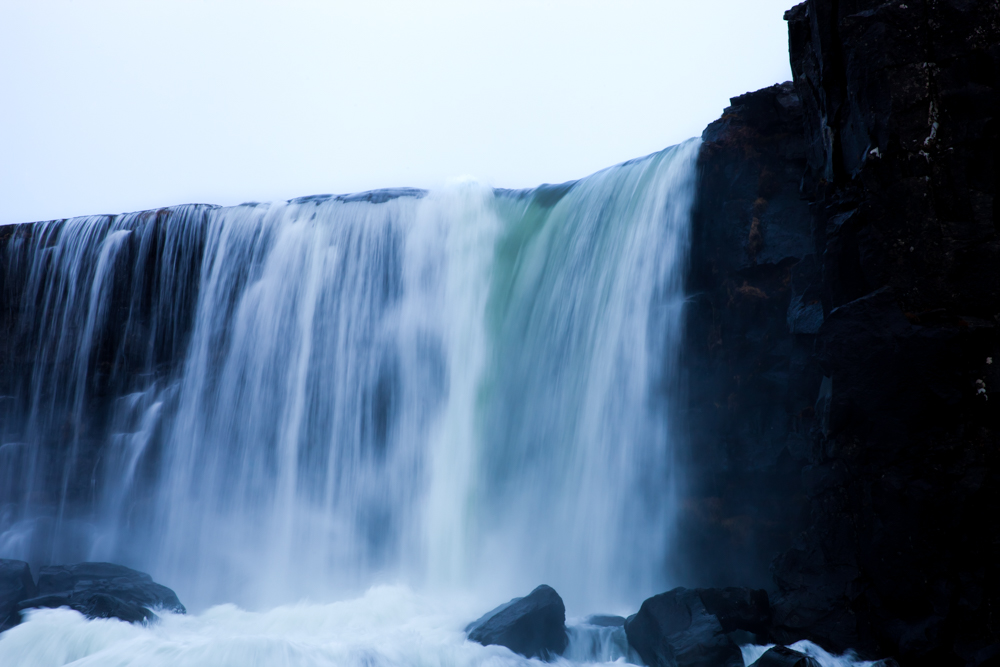
The hraunfossar waterfall is accessible from the city of Borganes, West iceland, by the road 50 and the road 518. More precisely , Hraunfossar is a serie of small waterfall along a distance of 900 meters, falling from the cliff to the Hvita river.
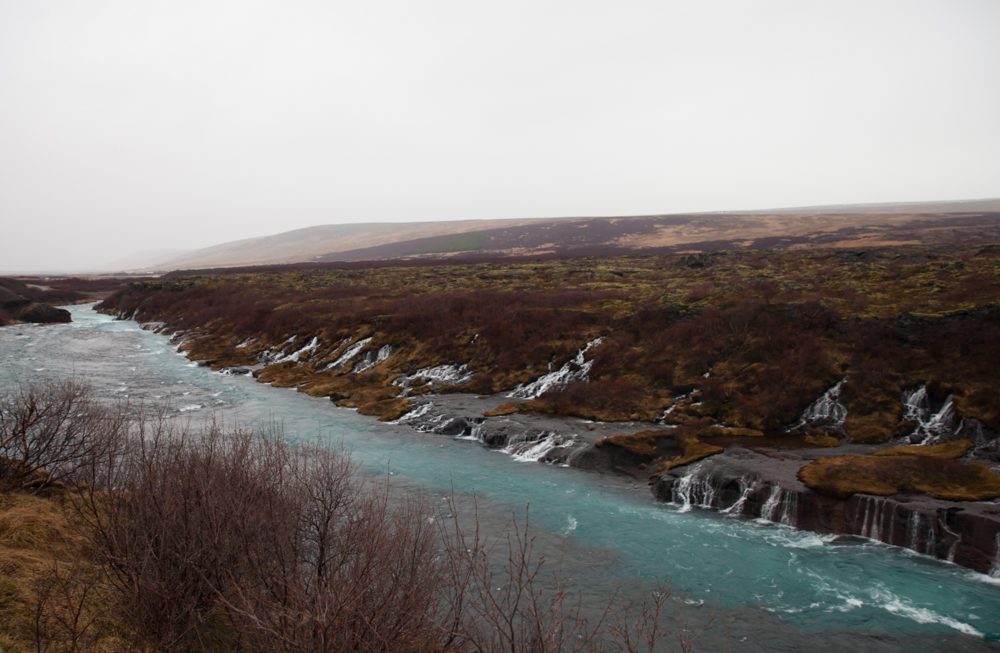
Hraunfossar is not the easiest subject to gets on photography, considering the wide distance and the shape of the valley.
location coordinates GPS : 64.70284, -20.977214
64°42’10.4″N 20°58’38.1″W
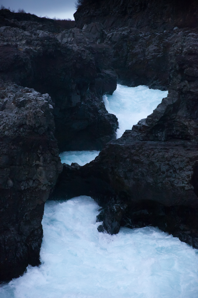
Barnafoss
On the Hvita river, Barnafoss is just a little bit more far away from Hraunfossar, the stream is powerful and of a nice blue color.
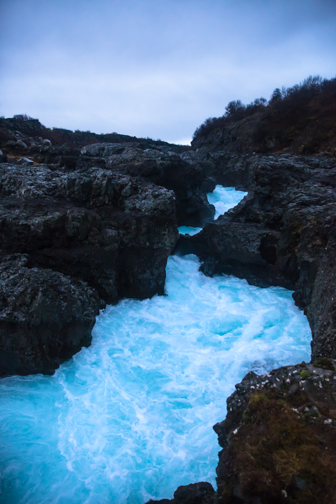
Its name, Barnafoss, means the waterfall of the children. There was a natural stone bridge over the waterfall.
Legend : Two children from a nearby farm who wanted to join their parents at church, fell off the bridge and drowned. Two versions then differ: the first induces that the angry mother ordered the destruction of the bridge, the second claims that the mother would have cursed the bridge using an Icelandic rune, the bridge and the curse would have disappeared simultaneously following an earthquake !!
location coordinates GPS : 64.70245, -20.97727
64°42’06.9″N 20°58’20.6″W
Dettifoss
Another top in this Iceland waterfall guide, Dettifoss is the cascade which appear at the beginning of the film Prometheus from Ridley scott in the Alien serie, a beautiful, dramatic and impressive scene . The view is taken from the east bank in the movie. Dettifoss is on the road after Reykjahlid at Myvatn lake in direction to Egilsstadir.
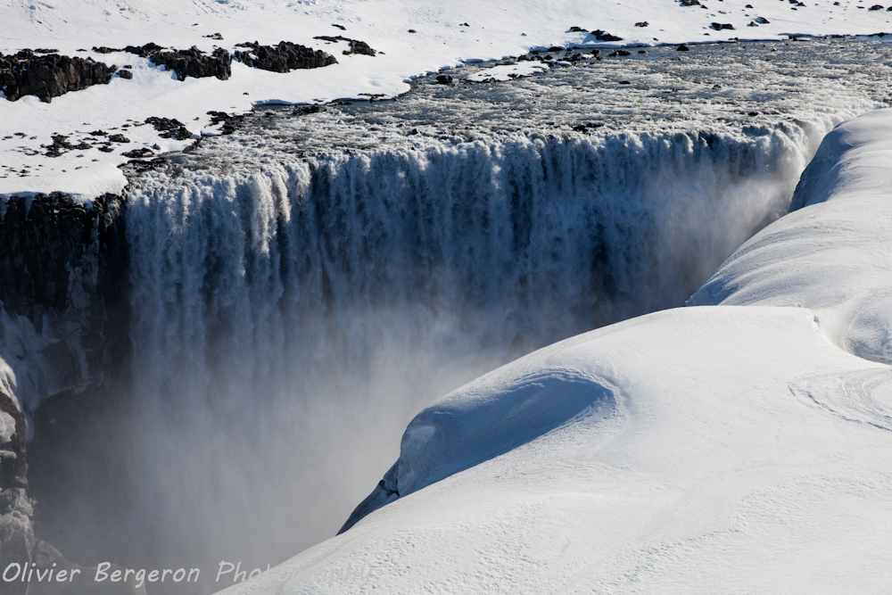
Dettifoss is considered the most powerful or the second most powerful waterfall in Europe. Catastrophic floodings of the Jokulsa a fjollum river have eroded the valley and created the canyon. The latest research concludes that the Jökulsárgljúfur canyon was formed by three flooding events which have occurred two, five and nine thousand years ago, separated by millennia of relative stability. The width of Dettifoss is around 100 meters (330 feet) and her height of 44 meters (144 feet).
Until now i gone to dettifoss in winter, using the road 862 , the road 864 to the east bank being closed in winter. The road 864 is open in summer normally. You have access to some parkings on the site.
Tips : In winter, you can have 30 centimeters of snow or more on the site, walking to the cascade is not always easy, take good hiking shoe or snowshoes, yes i’m serious. Personnally i use the Timberland 6 inch boot and some crampons. Despite the equipment, prepare to some funny or not funny fall in the snow !!!
Make me pleasure, don’t walk there with summer basket in the heart of winter.
Ah and take care about the black ice ont the road 862 !!!
The region is rich of site, you can combine the visit of Dettifoss with the visit of Myvatn lake, Grjótagjá, the krafla crater, the Hverir geothermal area with his boiling mud pits and swimming in the Myvatn nature bath hot spring , my little hedonist pleasure in this region.
location coordinates GPS : 65.81478, -16.38470
65°48’52.8″N 16°23’04.9″W
Selfoss
In the north, Selfoss is a few hundred meters upstream of Dettifoss. It lays in a magnificent portion of the canyon , cut by the Jokulsa A Fjollum river.
A huge amount of mist surround the cascade but it’s possible to catch a rainbow on photography sometimes over the canyon.
location coordinates GPS : 65.80512, -16.38679
65°48’18.6″N 16°23’12.6″W
Urridafoss
An excellent stop on the road 1, Urridafoss waterfall is located between Selfoss city and Hella. It is often overlooked by tourist speeding up to Vik but Urridafoss deserve better. The landscape is nice and the flow of the river is very strong there.
From the road 1, you need to turn on the urridafossvegur. There is a parking on the site.
location coordinates GPS : 63.92465, -20.67217
63°55’28.8″N 20°40’20.0″W
Dynjandi
One of the top, in this guide of best waterfalls in Iceland, Dynjandi is a majestuous waterfall in the Westfjords. My first try to visit her was a failure in winter, the road 60 being closed. We also change our hotel at the last minute. Iceland come with surprise !!!
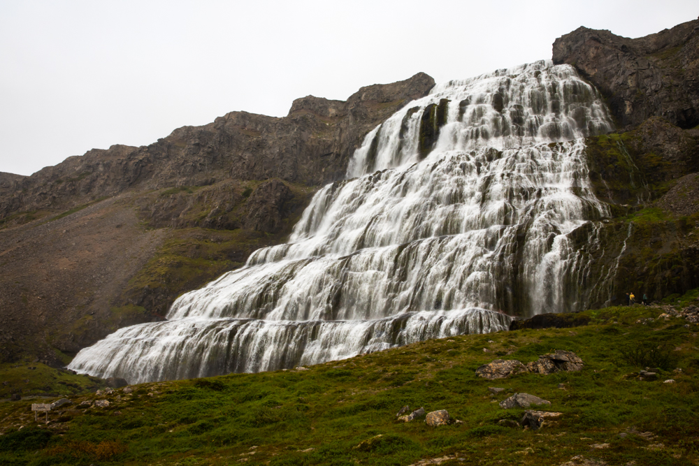
Finally i can get there in summer and the site worth the trip.
The landscape along the road 60 are very beautiful and of a pure desolation. A small path allow you to climb until the base of the waterfall. Dynjandi is very large and has a height of around 100 meters. Below Dynjandi you will find many waterfall which we describe under in this article. Flying drone on the site is forbidden.
After this visit we drive until Tingeyry, a fisherman village for the night rest.
location coordinates GPS : 64.88603, -23.64312
64°53’09.9″N 23°38’35.2″W
Fossalar
Let me know your favorite one by dropping a comment !
I hope this Best waterfalls In Iceland guide will be helpful to you for planning your trip.
Complements Of the
Best Waterfalls In Iceland Guide
You may be interested in :
The Hot Springs In Iceland Guide
Reference To the Best Waterfalls In Iceland Guide
List of waterfall in Iceland – Wikipedia